
Polynesian Wayfinding and Celestial Navigation
When history speaks of the great explorers of the world we often hear brave stories of conquest and discovery. These stories, with the likes of Magellan, the Vikings and Columbus, tell of men voyaging into the open ocean to discover new lands. However, you may not have learned in school that no other peoples on earth voyaged across vast distances to establish large colonies of people such as the ancient Polynesians did.
History Of Wayfinding & Celestial Navigation
Hundreds of years before the ancient Vikings ventured past the sight of land and over 1000 years before Europeans did so, Polynesians had developed technological advances in long distance voyaging that enabled them to travel thousands of miles across the Pacific ocean.
Today we are learning more about ancient polynesia than in any time since their discovery by western explorers over 200 years ago. Archaeologists, anthropologist and DNA experts are studying the origins of the Polynesian people whose nation covered more area than all the land mass of earth combined. It is a fascinating story that continues to evolve to this day. At the center of this story is how multiple migrations may have reached farther and perhaps happened much longer ago than past historians believed…
The Lost Art Of Wayfinding
By the mid 21st century the ancient art of long distance wayfinding (without western navigational instruments) was all but lost to the polynesian societies of the Pacific. The ancient polynesian colonizers developed highly sophisticated vessels and a navigation system based on observations of the stars, ocean swells, flight patterns of birds and other natural signs which enabled them to find their way across the open ocean. These colonists carried all that they would need to survive at sea for a month or more while sailing there amazing double hulled canoes. It is said some voyaging canoes could have carried as many as 80 people as well as the plants and domesticated animals needed to build a new life.
Ancient Roots Of Polynesia
Ancient Polynesian voyagers may have had many reasons to venture into the unknown open ocean. Some may have been fleeing war or famine and some were simply exploring for the adventure of discovery. While the timing of the Pacific migration is disputed, it’s believed Polynesians reached Samoa and Tonga as early as 1200 B.C. From there they fanned out to the Marquesas Islands as early as 300 A.D, eventually heading north to the Hawaiian Islands. Around 1100 A.D. the Polynesians also voyaged southwest of Tahiti to the islands of Aotearoa, which is today’s New Zealand.
Their migrations through the Pacific continued for some 3000 years with the discovery of Hawaii’s archipelago’s sometime around 450 A.D. Several migration periods ensued with what some mo’oleo (stories and legends) describe as an invasion of Hawaii by Tahitian warrior chiefs and priests around 1000 A.D.
For some unknown reason travels to Hawai’i from the southern islands ended sometime between the 12th and 13th centuries. For the next 600 years the isolated Hawaiian Island group developed into one of the most sophisticated cultures in the Pacific.
Polynesian Origins
Ancient Voyagers of the Pacific
There are several ongoing theories about how the Polynesian Triangle, an area of the Pacific ocean encompassing millions of square miles of open ocean, was settled and were these voyagers originated from. Most scholars believe polynesians originated in southeast Asia. DNA evidence shows all polynesians are descended from one race of people. But where did they originate from and how far did they travel?
One alternate theory was championed by explorer Thor Heyerdahl in 1947 when he famously sailed a wooden raft, called the Kon-Tiki, from the coast of Peru to the Tuamotu Islands in French Polynesia some 4300 miles away using only wind and currents. His theory and voyage was based on the sweet potato, a food source cultivated throughout all polynesian societies. DNA testing of these potatoes brought back by Cook in the late 1700’s from Hawai’i show they are a strain from south America. However, other recent evidence suggests the polynesians reached South America and introduced chickens (not native to South America) while possibly bringing back to central Polynesia the sweet potato. Chicken bones found in Peru have been carbon dated to 1350 A.D.
Another theory is native Alaskan Inuits may have voyaged to Polynesia, or vice versa, with a highly sophisticated canoe similar to the Polynesian canoes. Scientists have observed Alaskan natives may have physical features that resemble the Polynesians of Hawai’i and DNA evidence suggests a connection. However most scholars now believe the original peoples who became the polynesians originated in southeast Asia, possibly Taiwan. How Polynesians became linked to Alaska remains a bit of a mystery.
This ocean canoe is of the Haida tribe located in the archipelago of Haida Gwaii (formerly the Queen Charlotte Islands) in northern British Columbia. The construction resembles a Polynesian technique of carving large logs and lashing planks together to create a rugged, seaworthy vessel. The Haida tribe is also known to decorate their face and bodies with tattoos, as the Polynesians also do.
Additionally some 200 years ago a southern Californian Indian tribe was discovered to have in use a type of canoe constructed (large canoes built up of planks lashed together, and with seams caulked tightly) much as the polynesians had built but with no similar canoes existing among the many west coast tribes of the time. These connections continue to intrigue researchers and these theories will continue to be put to the test in the future…
Navigational Techniques Of Ancient Polynesia
Ancient Polynesian wayfinders use a series of techniques to navigate into unknown areas of the vast Pacific ocean. These included the flight of birds, star positions, ocean currents and waves, air and sea patterns caused by islands and atolls and the behavior of ocean animals.
Bird Observation
It is known, through ancient oral histories, that long distance Polynesian voyagers followed the seasonal paths of migrating birds. A voyage from Tahiti or Samoa to the Cook Islands or New Zealand may have followed the long tailed cuckoo. Voyages north to Hawai’i might have followed the track of the Pacific Golden Plover along the West Pacific Flyway. It is also known that Polynesians used shore sighting birds, bringing with them Frigate birds, who refuse to land on the water as their feathers would become waterlogged. When voyagers thought they were close to land they would release the bird. It would either fly towards land or return to the canoe.
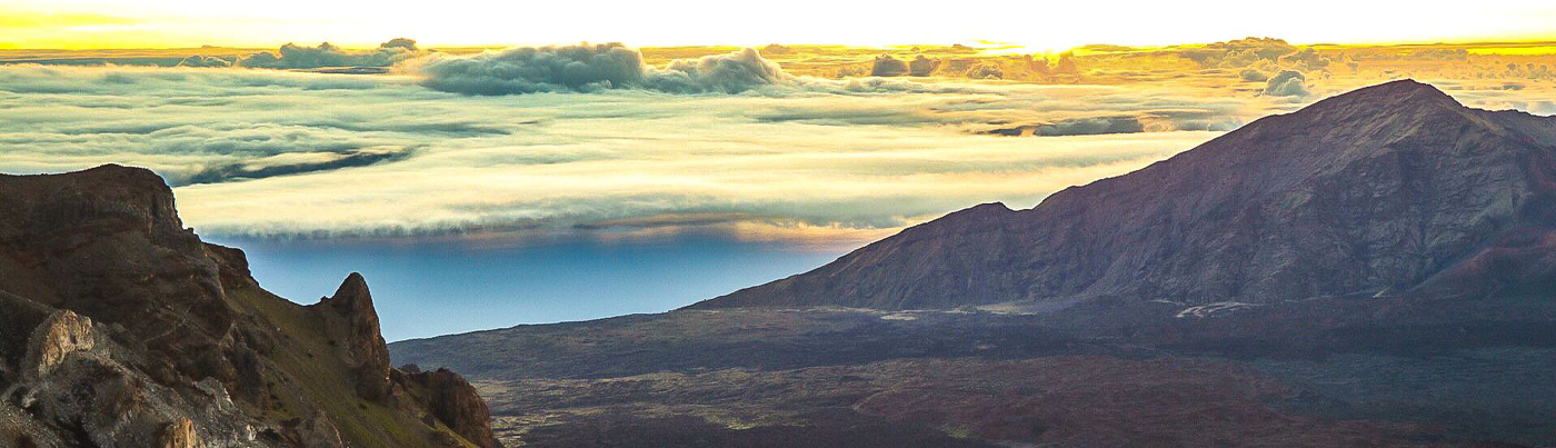
Experience the Famous Haleakalā Sunrise Tour
Navigation By The Stars
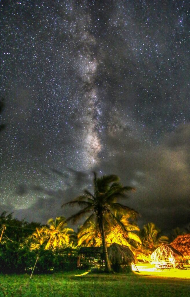
The most important time of day for ancient navigators was just before sunrise and just after sunset. The night sky near the equator is simplified since the whole celestial sphere is exposed. Each star has a specific path to the ancient wayfinder and when they rise or set they give a bearing for navigation.
The navigator would take stellar measurements of elevation, often using just their fingers, to determine their latitude. The latitudes of specific islands were memorized, employing the technique of “sailing down the latitude” to return to found islands or home. This resulted in the making of a star compass. For short voyages a star compass may only have a few dozen stars while longer voyages could plot over 150 stars!
Ocean Swells
Ancient Polynesians also used the ocean to navigate. Waves and swells could signal the presence of islands and atolls by their effects on the ocean currents. Navigators who lived within a group of islands would observe and learn the effects various islands had on the shape, direction and motion of the currents, allowing them to correct their sailing path in conjunction with the changes they observed.
After arriving close to their navigational reckoning, they would begin to pinpoint a location using sightings of birds, ocean currents, cloud formations and reflections of shallow water on the underside of clouds. It is thought that the Polynesian navigators may have measured the time it took to sail between islands in “canoe-days” or a similar type of expression.
Captain Cook’s Voyages
European Contact in the South Pacific
Polynesian voyagers are believed to have arrived in Hawai’i sometime around 450 A.D., which is close to 1000 years before Columbus crossed the Atlantic Ocean.
The first scientific voyages by Europeans into the South Pacific were conducted by Captain James Cook in the late 18th century, though he used captured Spanish maps from the mid 1500’s to plot his course. It is believed the Spanish kept the South Pacific Island locations secret to dissuade pirates and colonizers. Luckily Cook was neither and managed to befriend most of the Polynesians he encountered. On his first of three voyages he had the services of a polynesian navigator from Tahiti named Tupaia, who drew a map of the islands within a 2000 mile radius of his home island of Ra’iatea. He had knowledge of 130 islands and named 74 on his map.
Cook believed the presence of Polynesians across such vast expanses was due to islanders who were driven off course by storms. The prevailing trade winds running east to west would seemed to have prevented exploration to the east of the central Pacific Islands. Thus the reason Polynesians were able to inhabit such a large number of Pacific islands was given to luck. This view was upheld for nearly 200 years. Some believe it was a form of bigotry, with westerners not wanting to believe a “savage and primitive” culture could accomplish such voyaging capabilities 1000 years before Europeans.
By the late 19th century historians such as Abraham Fornander and Percy Smith hypothesized a more courageous and romanticized view of Polynesian navigation, bringing into favor the idea of great seamanship, sophisticated voyaging vessels and navigational expertise. This reassessment caused much controversy and debate through the late 19th and into the early 20th centuries.
20th Century Polynesia
Discoveries and Experiments
By the mid 1960’s scientists and historians believed it was time for a more hands-on approach. Ethnographic research in Micronesia discovered that the people living there still used traditional stellar navigation in their everyday lives.
In the late 1960’s anthropologist David Lewis sailed a catamaran from Tahiti to New Zealand using celestial navigation without instruments. Anthropologist and historian Ben Finney built a 40 foot replica Hawaiian double hulled canoe, doing a series of sailing and paddling experiments in Hawaiian waters. All of these studies concluded the Polynesians did have the skills and knowledge to voyage throughout the vast Pacific ocean, making them the most adaptive seafaring peoples the world has ever known.
Reviving Ancient Navigation
Back in the mid 1960’s Herb Kane (celebrated Hawaiian artist-historian and author), along with Ben Finney (anthropologist studying Polynesian navigation, canoes and surfing) and Tommy Holmes (Pacific history scholar and waterman), became disturbed about the current beliefs of the origins of the polynesian race of peoples. Individuals like Thor Hyerdahl suggested that Polynesians could not sail upwind and into weather to purposefully colonize the Polynesian Triangle, they could not have come from Asia traveling west to east against the tradewinds and that their canoes were not very seaworthy. Thor believed the Polynesians were from Central America, peoples who were blown into the Pacific by storms.
Other’s, like Andrew Sharp in New Zealand, said that from an anthropological point of view, Polynesians came from an Asian origin but were not skilled enough to navigate more than 100 miles in the open ocean. Sharp believed they too were blown east in typhoons and by pure luck found the islands within the Pacific triangle.
Herb, Ben and Tommy came together, wanting to debate these theories. They knew the only way to do this was to build a canoe and sail it to Tahiti.
By 2015, Hōkūle‘a celebrated 40 years of voyaging since launching from the sacred shores of Kualoa in Kane’ohe Bay O’ahu in March of 1975. The voyaging canoe ushered in a generation of pride and renewal for the Hawaiian people. While revitalizing ancient voyaging and navigation traditions throughout polynesia, Hōkūle‘a brought newfound respect and appreciation for Hawaiian culture and language. It is this culture of Aloha that brings visitors from around the world back again and again to Hawai’i.
Recent re-creations of Polynesian voyaging have used methods based largely on Micronesian methods and the teachings of a Micronesian navigator, Mau Piailug.
By the mid 21st century most Pacific islanders knew nothing about how to navigate long distances using ancient wayfinding techniques. To the rest of the peoples of the southern islands of the Pacific, Hawai’i was an isolated cousin overtaken by a western way of life.
All that changed in the early 1970’s when the newly formed Polynesian Voyaging Society began building a replica of an ancient double hulled voyaging canoe (called a wa’a kaulua in Hawaiian). The knowledge of how to accomplish this was lost to time but a talented artist and historian, who had been painting scenes of ancient Hawai’i for years, came up with a drawing for the first Hawaiian voyaging canoe. His name is Herb Kane and the canoe was christened Hōkūle‘a. The canoe’s name refers to the guiding star that led ancient voyagers to Hawai’i. The name Hōkūle‘a means “Star of Gladness” and refers to Arcturus, the guiding zenith star which passes directly overhead at Hawaii’s latitude.
The Story Of Hōkūle‘a
1950 – Eighteen-year-old Mau Piailug is initiated as a master navigator in a Pwo ceremony on the island of Satawal.
1973 – The Polynesian Voyaging Society is founded by artist Herb Kawainui Kāne, anthropologist Ben Finney, and sailor Charles Tommy Holmes.
1975 – Hōkūleʻa is launched for the first time from Hakipuʻu/Kualoa, Oʻahu.
1976 – the crew of Hōkūle‘a successfully navigates to Tahiti and back without the use of western navigational instruments.
1978 – the Polynesian Voyaging Society and the world mourn the passing of crew member and renowned big wave surfer Eddie Aikau when Hōkūleʻa capsizes off the coast of Lānaʻi.
1999 – Hōkūleʻa sails to Easter Island, successfully visiting the three outer corners of the Polynesian Triangle.
2000 – On Hōkūleʻa’s 25th birthday, Governor Cayetano proclaimed Hōkūleʻa as Hawaiʻi’s first state treasure.
2007 – Five Hawaiian navigators are initiated into the ranks of master navigator in a Pwo ceremony conducted by Mau Piailug.
2012 – His Holiness the Dalai Lama conducts a blessing for the Mālama Honua Worldwide Voyage while Nobel Peace Prize laureate Archbishop Desmond Tutu blessed the voyaging canoe Hōkūleʻa during a private ceremony at Honolulu Community College’s Marine Education and Training Center.
2014 – The Polynesian Voyaging Society launches the first international leg of the Mālama Honua Worldwide Voyage, sailing Hōkūleʻa and her sister voyaging canoe Hikianalia to Tahiti for a three-year circumnavigation of the earth.
2017 – Hōkūleʻa returned to O’ahu on June 17, 2017 after completing the voyage around the world voyage. The journey covered 47,000 nautical miles with stops at 85 ports in 26 countries!
Nainoa Thompson
Hawaii’s Wayfinder
Nainoa Thompson became the first Hawaiian Wayfinder of the Polynesian Voyaging Society and is their current President. He was on the first voyage to Tahiti in 1976 with Mau Piailug as navigator and since 1980 Nainoa has navigated close to 100,000 ocean miles aboard the Hōkūle‘a. Because of him the traditional principles of wayfinding are being taught in schools throughout Hawai’i and the Pacific. Nainoa is a skilled navigator, storyteller and leader with a vision to teach future generations about Polynesians and their seafaring culture.
Nainoa speaks of when he first became involved with Hōkūle‘a as a youth while paddling canoe on O’ahu:
“One day, Herb invited two of the paddling coaches and me over to his house. Herb’s house was filled with paintings and pictures of canoes, nautical charts, star charts, and books everywhere! Interesting books! Over dinner Herb told us how they were going to build a canoe and sail it 2,500 miles without instruments-the old way. ‘We’re gonna follow the stars, and the canoe is gonna be called after that star” Herb said, pointing to the star Hōkūle‘a. This voyage would help to show that the Polynesians came here by sailing and navigating their canoes-not just happening to drift here on ocean currents or driven by winds. The voyage would do something very important for the Hawai’ian people and for the rest of the world.
“In that moment, all the parts connected in me that had seemed unconnected in my life. I was 20! I was looking for something challenging and meaningful! I had a hard time finding that in the four walls of the school. Here it was- in the history, the heritage, the charts, the stars, the ocean, and the dream … there was so much relevance in that dream. I wanted to follow Herb; I wanted to be part of that dream.”
Nainoa on the History of Polynesians
An excerpt from Hōkūlea.com:
We are taught in our history books today that the inhabitants of the Polynesian triangle were a people of common language, of common ancestry, of great achievements in exploring the earth. Consider the fact that there was no other culture in their time that was ocean-going … deep sea ocean-going. In my opinion, these explorers were the greatest explorers on the earth at the time. If you exclude the total land mass of Aotearoa, there is three hundred times more water than there is land … ten million square miles of ocean. And that is what makes their achievements more amazing. This is geographically the largest “nation” on earth. It’s bigger than Russia. There was adze found in the artifacts on the beaches of Australia that are Polynesian. And also, through the sweet potato, we know that there was contact to the Americas. And just in recent times through the new science of genetics, there is evidence showing that the Native Alaskans, Haida Indians, have Polynesian blood.
Learn more on the Road to Hāna
Nainoa Thompson on Mau Piailug
1976, the first voyage to Tahiti: We were facing cultural extinction. There was no navigator from our culture left. The Polynesian Voyaging Society eventually found a traditional navigator to guide Hōkūle‘a – a very special man. Without him, we have to realize that our voyaging would never have taken place. His name is Mau Piailug and he is from a small island called Satawal in Micronesia.
Techniques of Ancient Navigation
Mau Piailug has revived Polynesian voyaging with his memorization of the ancient star compass taught to him by his father.
It works like this: at sunset stars begin to appear and a course is set to a particular known star. Mau has memorized over 150 stars and their paths. As the stars rise in the sky they begin to arc and loose a constant direction. Another star rises in it’s place that has a known direction and the course is set to it. This may happen 2 to 3 times in one night. The most important time of day for ancient navigators was sunrise. The course would be checked by the last visible stars, while attention was given to wind, wave and current directions. This would be the course during the day until the stars returned after sunset.
Nainoa Thompson on Star Compass Wayfinding
The star compass is the basic mental construct for navigation. We have Hawaiian names for the houses of the stars – the place where they come out of the ocean and go back into the ocean. If you can identify the stars as they rise and set, and if you have memorized where they rise and set, you can find your direction.
The star compass also reads the flight path of birds and the direction of waves. It does everything. It is a mental construct to help you memorize what you need to know to navigate.
You cannot look up at the stars and tell where you are. You only know where you are in this kind of navigation by memorizing where you sailed from. That means constant observation. You have to constantly remember your speed, your direction and time. You don’t have a speedometer. You don’t have a compass. You don’t have a watch. It all has to be done in your head. It is easy-in principle-but it’s hard to do.
The memorization process is very difficult. Consider that you have to remember those three things for a month-every time you change course, every time you slow down. This mental construct of the star compass with its Hawaiian names is from Mau. The genius of this construct is that it compacts a lot information and enables you to make decisions based on that information.
How do we tell direction? We use the best clues that we have. We use the sun when it is low down on the horizon. Mau has names for the different widths and the different colors of the sun’s path on the water. When the sun is low, the path is narrow, and as the sun rises the path gets wider and wider. When the sun gets too high you cannot tell where it has risen. You have to use other clues.
Sunrise is the most important part of the day. At sunrise you start to look at the shape of the ocean-the character of the sea. You memorize where the wind is coming from. The wind generates the waves. You analyze the character of the waves. When the sun gets too high, you steer by the waves. And then at sunset you repeat the process. The sun goes down-you look at the shape of the waves. Did the wind direction change? Did the swell pattern change? At night we use the stars. We use about 220, memorizing where they come up, where they go down.
When it gets cloudy and you can’t use the sun or the stars all you can do is rely on the ocean waves. That’s why Mau told me once, “If you can read the ocean you will never be lost.” One of the problems is that when the sky gets black at night under heavy clouds you cannot see the waves. You cannot even see the bow of the canoe. This is where traditional navigators like Mau are so skilled. Lying inside the hull of the canoe, he can feel the different wave patterns as they come to the canoe, and from them tell the canoe’s direction.
Mahalo for taking an interest in Hawaiian culture and ancient navigation! We enjoy sharing this kind of information on every one of our Maui tours. From our road to Hana tour to Haleakala National Park, we would be honored to share with you the unique sights, history and culture of Maui!
Aloha Nui Loa
References:
Links for Polynesian Voyaging & Wayfinding
https://archive.hokulea.com/index/founder_and_teachers/nainoa_thompson.html