Hawaii’s Volcanoes
TYPES OF VOLCANOES
Most volcanoes of the world are not shield volcanoes. The eruptions of volcanoes like Mount St Helens or the recent eruption of Fuego in Chile are stratovolcanoes. These types of volcanoes have steep sides and produce sudden violent eruptions that send pyroclastic flows of 1000 degree clouds of ash and gases rocketing down the steep slopes at over 100 miles an hour. There is no evidence that this has happened with Hawaii’s shield volcanoes. In fact, geologists have deemed the Big Island volcanoes to be THE safest volcano in the world to observe and study. Kilauea has been erupting continuously since 1983 making it the longest lasting eruption in history and is monitored 24/7.
BIG ISLAND OF HAWAIIʻS VOLCANOES
The Hawaiian Islands are made up of 19 volcanoes on eight main islands and there have been over 75 eruptions in the last 200 years. The islands are what geologist call a volcanic trial which results from the Pacific tectonic plate moving over a hot spot in the Pacific ocean. This is unique in that most of the world’s volcanoes are situated along the earth’s “ring of fire” at the edges of this tectonic plate which is one of the reasons why they erupt suddenly and catastrophically. Hawaii is basically in the middle of this plate and the islands created by this hotspot reach all the way to Siberia!
However the Big Island has had its share of explosive growth, the most devastating having happened at the largest of the five – Mauna Loa. Measured from the ocean floor Mauna Loa is the largest volcano on earth. It is 13,680 ft in elevation from sea level and another 14,000 ft to the ocean floor making it over 27,000 ft high!
The earliest record of a Kilauea eruption after western discovery was in 1790 when the summit erupted suddenly sending an ash cloud an estimated 20,000 ft into the air. We know this because Kamehameha was fighting for control of the island at the time, and the chief and warriors he was battling tried to escape over the summit. The eruption asphyxiated several hundred, perhaps thousands, of Hawaiian warriors and left footprints in the ash layer that can be seen today. It was seen as a prophecy, an approval by Pele for Kamehameha to continue his quest to become the sole ruler of the Hawaiian archipelago.
Since 1832 Mauna Loa has erupted 39 times. In 1984 it’s steep slopes sent lava to the ocean at a speed of 9 ft per second, which is about 6 miles per hour. The lava flow stopped just short of of Hilo, which would have been devastating to the port town.
At the time geologist were amazed that both volcanoes, Kilauea and Mauna Loa, were erupting at the same time. That had not been seen before. Mauna Loa is much larger and higher than Kilauea, meaning it can send lava flowing down on three sides. An eruption of this volcano could affect some 100,000 residents today.
Explosive Eruptions of Kilauea
One of Kilauea’s larger explosive eruptions happened at Halema’uma’u Crater in May of 1924. The collapsing walls of the crater (following the withdrawal of lava from the crater in February) blocked steam rising from the water table causing pressure to build, triggering an explosion that hurled 14 ton rocks as far as ½ mile away!
Mauna Loa Eruptions
Mauna Loa is nearly 10,000 ft higher than Kilauea. It is historically not as active as Kilauea but this volcanoes eruptions have generated as much as 10 times more lava output. It last erupted in 1984. Mauna Loa lava flows tend to move much faster than Kilauea. A 1950 eruption of Mauna Loa emitted in three days as much lava as Kilauea emitted in three years! The same eruption reached the sea within four hours of its start.
Possible Tsunami
Hawaiian shield volcanoes produce very slow-moving lava, but one of the most destructive events would be a massive collapse of the volcanoes flanks along deep fault lines. The ensuing landslide could trigger a tsunami or even mega-tsunami such as the 1000 ft high tsunami that struck Lana’i around 100,000 years ago.
MAUI’S VOLCANOES
Haleakala and the West Maui Mountains
Maui is the closest island to the Big Island in the chain and has one of the most visited volcanoes in the state – Haleakala. Eruptions have not happened here for hundreds of years but it is not considered extinct, only dormant. Haleakalā has erupted only three times in the last 900 years with the last one in the lower southeast rift zone, an area known today as La Perouse Bay. Though it was originally thought that the eruption took place in 1790, advanced testing has shown the last eruption to have been sometime in the mid 1600’s.
Haleakala National Park
Maui’s “House of the Sun”
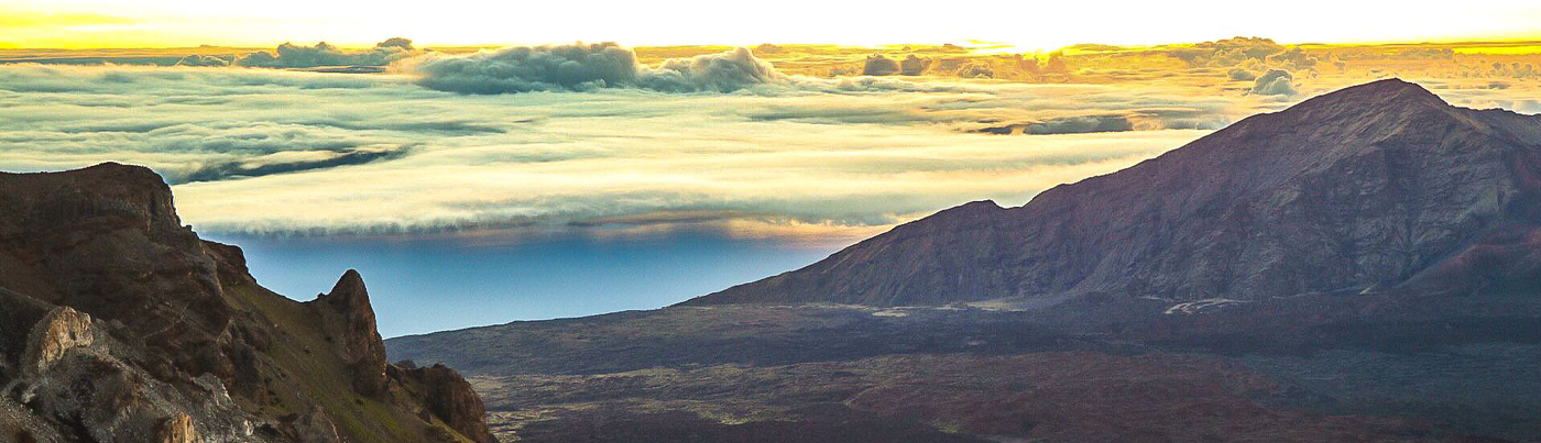
Haleakalā (meaning “House of the Sun”) is Maui’s dormant volcano and this National Park is one of the most popular visitor attractions on the island. Over 1 million visitors a year enter this park at both the summit and the Kīpahulu entrance along the road to Hāna. Sunrise at the summit is a Maui must see and has become so popular that the Park has instituted a reservation system to get in. Be sure to book a reservation well in advance as spots fill up quickly.
If you wish to be sure to see Haleakala’s stunning sunrise you might want to book a sunrise van tour. Depending on where you are staying on Maui you will need to leave for the summit between 2:30 am and 4:30 am. You can do the drive yourself but it’s nice to have a tour van pick you up. Aside from doing the driving tours will often provide coffee and breakfast which makes it a relaxing journey as you traverse up the 38-mile switchback road in the dark. A tour is also a great way to learn about the culture, geology, and history of the volcano from a knowledgeable guide.
Interestingly Haleakalā’s crater is not really a crater but an erosional valley consisting of two volcanic vents. These two volcanic peaks collapsed hundreds of thousands of years ago creating the deep expansive valley seen today. Later eruptions formed the cinder cones scattered throughout the valley floor. Red, black and brown streams of volcanic cinder seems to flow down from the crater walls adding to the stunning colors of sunrise. It is a magical experience and it’s no wonder native Hawaiians consider it sacred!
Mauna Kahalewai
Iao Valley State Park & Peaks of West Maui
Iao Valley (pronounced ee-ow) is located just above the town of Wailuku and is the erosional remnants of a large shield volcano that formed the West Maui Mountains over 1 million years ago.
Iao Needle is actually a basaltic core remnant of the volcano. Mauna Kahalewai (West Maui Mountains) have the second highest rainfall of anywhere in Hawaii at nearly 400 inches per year. The erosional effect of this rain over hundreds of thousands of years created the Iao Needle which is a towering ridge that looks like a free-standing spire. It stands 1200 ft above the valley floor and 2,250 ft above sea level.
These mountains make up the western one-quarter of the island. Called Mauna Kahalewai by ancient Hawaiians (meaning “holding house of water”) this shield volcano last erupted around 320,000 years ago. The highest peak of the Kahalewai, Pu’u Kukui, stands at the back of the valley at 5,788 ft elevation.
It is one of Maui’s most beautiful state parks and a great stop on our Volcanoes of Maui Tour. Walkways, bathrooms, a bridge, remnants of an ancient Hawaiian village and streamside trails are maintained throughout the park.
Wailuku means “waters of destruction” and this seemingly peaceful stream in the valley has been just that. In 2016 floodwater destroyed portions of the park and damaged many homes in the valley below as well as in the upper parts of the town of Waikuku. It took a year to clean up the debris and build abutments and retaining walls to mitigate future flooding. The park re-opened in 2017 with a new parking area, paths, and stairways.
EARTHQUAKES IN HAWAII
The current eruption of Kilauea has seen nearly a thousand small earthquakes per day at the summit and several strong quakes in the Puna district which included a 6.9 magnitude in May 2018. Even though the Big Island can average a thousand small quakes per month, from May 4th to June 5th of 2018 over 12,000 were recorded in 30 days!
Records show that on average about 100 magnitude 3 (M3) or greater earthquakes have occurred in Hawaii each year since 1823. Additionally, the state also experiences 10 earthquakes at M4 or greater and one M5 or greater each year. This includes one M6 or greater every ten years and two M7 or greater every 100 years.
An earthquake in 2006 (M6.7) caused damage to homes and buildings on the Big Island (no one was hurt). The quake also damaged bridges on Maui and knocked out power on Oahu for two days. At 6.7 of the richter scale, it pales in comparison to the 1868 earthquake with a magnitude 8.0 – 12 times stronger than the 2006 quake. The difference is that there were few people on the Big Island back then and towns were small making damages manageable. Today large resorts and extensive residential areas are sitting on lava flows from past eruptions. Kona in the south, Hilo in the east, and Kohala in the northwest have all seen and felt earthquakes during eruptions over the last 200 years. Again, it’s nothing new to Hawaii residents.
MISCONCEPTIONS ABOUT KILAUEA’S ERUPTIONS
The current eruption is an ongoing tragedy for these Big Island residents, but the entire state’s tourism economy is taking a hit because of some basic misunderstandings about Hawaii’s volcanoes.
First and foremost is the perception of the size of the affected area of the Big Island eruption. The fact is it is relatively small. Hawaii Island is really big – over 4000 square miles big. All the other islands in the chain can fit on the Big Island with room to spare. If you look at a current USGS map of the Kilauea eruption and the fissures emitting fountains of lava flowing towards the sea, you may be surprised at how small it is.
Couple this with fact that the other islands are hundreds of miles away. Normally, and especially during the summer months, trades winds blow towards the Big Island. This helps keep the volcanic gases from spreading. The wind can and does change creating what is called vog – volcanic smog. This hazy layer can move down the island chain but mostly dissipates the farther it goes. Often there are only a few days of vog and then the trade winds return bringing with them the usual beautifully clear Hawaiian skies. Vog has been an ongoing occurrence for decades.
As for visiting the Big Island, I would be excited to view the volcano from the air and sea. Stunning photos and video are captured every day on tours right now and resorts are offering discounts to try and bring back lost business.
Another Hawaii volcano misconception is that Kilauea will have a Mount St Helens kind of explosion. This is not the norm with a shield volcano. Steam events with ash-fall have occurred during this eruption, but shield volcanoes are about flowing lava with high viscosity, a type of lava known throughout the world by it’s Hawaiian name Pahoehoe lava. The gentle slopes of the Big Island were created by it’s five shield volcanoes (Mauna Kea, Mauna Loa, Kilauea, Hualalai and Kohala) spreading lava out in many eruptive layers for over a million of years.
HAWAII’S RECENT VOLCANIC ERUPTIONS
As a professional photographer I’ve lived in Hawai’i for close to 30 years. As an 18 year old working in a photo lab in Maui, I remember when Kilauea volcano first began its current eruption in 1983 that is intensifying today. Volcanoes National Park and Observatory has had over 2 million visitors a year at the summit of Kilauea since then. The park has been closed since May 2018 due to the current eruptive steam events that have sent ash 10,000 ft into the air, dusting a large portion of the summit area.
There is a lot of coverage on the news about the 2018 spring and summer eruption of Kilauea volcano on the Big Island and it has been tragic for the people in the Puna and Pahoho districts who have lost their homes and land, including a beloved and sacred bay at Pahoho that is now completely filled with lava. However volcanoes are an ancient and sacred part of Hawaiian life and many residents believe that this land belongs to Pele, the Hawaiian volcano goddess and that she is taking her land back. People of Hawaii have always respected Pele.
Enjoy Hawaii’s Volcanoes!
Hawaiian volcanoes are as beautiful and diverse as the people who call the islands home. The volcano goddess Pele continues to build and enlarge the land and though she can be a fearsome force of nature, Hawaiians continue to respect and admire her power and beauty. They know this is her land and as a photographer I think it’s the perfect time to visit and see her in all her creative glory!
Aloha Nui Loa!