HALEAKALA NATIONAL PARK FACTS, HISTORICAL TIMELINES & MILESTONES
1164 – 1384: The current earliest evidence using calibrated radiocarbon testing shows dates ranging between 1164 A.D. and 1384 A.D. for Hawaiian habitation of the Kīpahulu area near Hana.
1828: The first written record of an ascent to the summit of Haleakala was made by three missionaries in 1828. (Richard Green, Lorrin Andrews & William Richards)
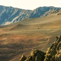
1841: Charles Wilkes of the United States Exploring Expedition traversed and mapped Haleakala crater and summit.
1888: Haleakala Ranch is established. Grazing of cattle begins on the slopes of Haleakala with cattle being pastured inside and outside of Haleakala Crater until 1922. Ranching is established in Hana’s Kīpahulu district after sugar production ends in the mid-1920’s.
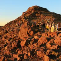
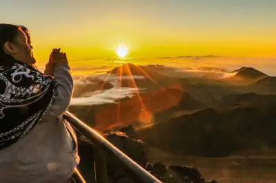
1890: Sunrise viewing at the summit of Haleakala had become a prime attraction. Horseback rides from Makawao to the summit began at 2:00am.
1894: The Crater Rest House was built at the crater’s rim near today’s Kalahaku Overlook.
1900: Organized tours to the summit increased with horseback expeditions originating from the Olinda area of upcountry Maui.
1915: Considered essential for the growth of tourism on Maui, local officials begin considering routes for a road to the summit as early as 1915.
1916: Hawai’i National Parks is established as a combination of three locations; Kilauea and Mauna Loa on the Big Island of Hawai’i and Haleakala on Maui.
1924-1925: Sleeping quarters, a concrete water tank and a lookout room were added to the Crater Rest House.
1925: Support for a road to the summit is granted by the U.S. Congress.
1933 – 1935: Finally a road to Haleakala’s summit is built and completed in two years.
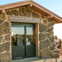
1936: The Haleakala Headquarters and Visitor Center at the park entrance is completed.
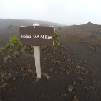
1937: Backcountry cabins are built and the trails to them are completed.
1941-1943: After the attack on Pearl Harbor, Haleakala National Park and the crater were closed to the public. It was occupied by the U.S. Army for training between 1941 and 1943. During this time buildings and a road were built to Red Hill where today’s observatories reside.
1950: The upper Red Hill road is open to the public for viewing the eruption of Mauna Loa in 1950.
1951: The upper slopes of Kipahulu Valley are added to Hawai’i National Park lands.
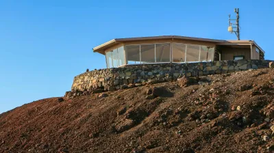
1954: Construction for a road and facilities begins for what would become Haleakala Observatories (also known as Science City).
1958: The Park headquarters is completed.
1961: Hawai’i National Parks is divided into two separate parks; Hawai’i Volcanoes National Park and Haleakala National Park.
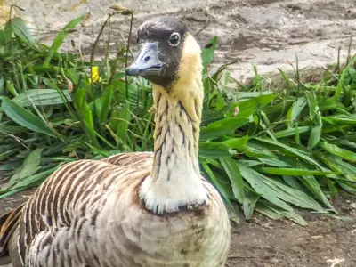
1962: Hawai’i State bird, the Nene Goose, is reintroduced to Haleakala in 1962. The geese have not been seen on the island since the 1890’s due to predation by introduced cats, rats, and mongoose, as well as habitat destruction from grazing cattle.
1963: Pu’u ‘Ua’ula (Red Hill) observatory and summit parking lot is built.
1967: An expedition into the upper Kipahulu Valley in 1967 discovers many new native Hawaiian species and rare birds thought to be extinct.
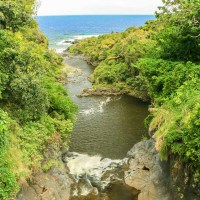
1969: Lower Kipahulu Valley and its coastal area are added to Haleakala National Park which includes the Pools of Oheo.
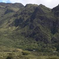
1974: Haleakala Crater is listed on the National Register of Historic Places.
1976: Fencing of park boundary begins. The fencing is designed to exclude feral animals such as goats and deer in order to protect park resources. This work continues today.
1980: The park is designated as an International Biosphere Reserve.
1999: Ka’apahu lands are added and the upper Kipahulu areas are enlarged.
2008: Former Nu’u Ranchlands in the Kaupo area are added to the parklands.
2015: Commercial-free days (no tour vans or vendors allowed) are added for Native Hawaiians to conduct cultural practices. Today about 5 of these days occur each year.
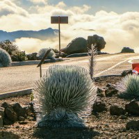
2016: Over 300 silverswords planted to strengthen at-risk populations in the summit area of the park.
WRONG SPELLINGS OF HALEAKALĀ
All over the internet we see all sorts of ways that the name of this National Park is spelt. It’s interesting to read through…
haleakalala
halehakelai
halekalaka
haiacala
holikolakala
haakalea
halacala
haleakak
halekala
kaleakala |
halia kala
halkawen
haleakaia
haulaklana
haleakala
halealkula
halakila
halaekala
haleakali |
haliakala
haklena
halealka
haliakila
haleaksla
haleakula
halekala
halekola
haleakela |